


Niagara Falls, a remnant of the last ice age
How the melting of the great Laurentian ice sheet created the Great Lakes system and the impressive Niagara Falls.

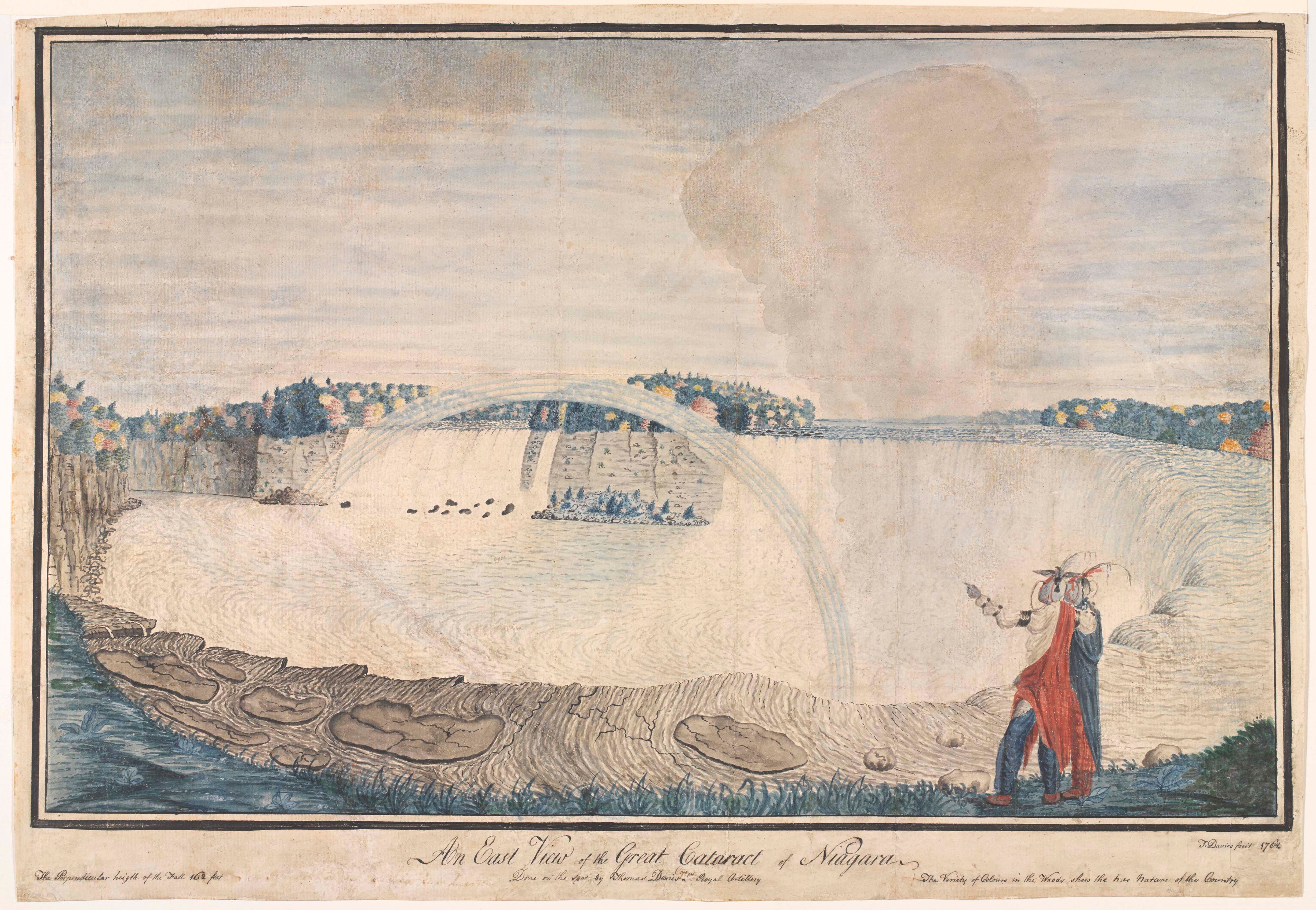
Niagara Falls is one of the most famous natural wonders in the United States. That great volume of water falling continuously1 can be seen in hardly any places in the world in such an accessible way.
I, like many people of my generation, discovered Niagara Falls on television, thanks to one of the many broadcasts of Superman II. In one scene, Clark Kent, known as Superman when dressed funny, rescues a young boy who was falling from an overlook. Surely, the child had been told hundreds of times by his parents not to be naughty, but Superman had to be there to allow the child to be punished later.

In another scene of the same movie, Lois Lane talks about how fascinating Niagara Falls is, something that, fortunately, I can say that it is impressive2. Don't miss them if you happen to be near them on a trip.
Today, more than just talking about how they look, I will focus on something that, in my opinion, is much more interesting. I'll tell you how this great natural wonder came to be.
The Laurentian ice sheet and Lake Agassiz
For more than 100,000 years, the entire northern part of North America was covered by the Laurentian ice sheet. This ice sheet spread over the entire territory now occupied by Canada, as well as a large part of the present-day United States, a total of 13 million square kilometres. In its central area, it reached a thickness of more than two kilometres, which together amounted to an ice volume of more than 25 million cubic kilometres. For reference, Antarctica today has only 30 million cubic kilometres of stored ice.
The Laurentian ice sheet went into recession about 20,000 years ago, which is the reason a major lake formed in the south: Agassiz. William Keating first theorised its existence in 1832, although it was Louis Agassiz3 who in 1879 proposed that this lake would have originated from melting ice. Over the following decades, the United States Geological Survey encouraged research on the lake, which led to Warren Upham's publication of the first map of Lake Agassiz in 1896.
")
The maximum extent of Lake Agassiz was reached 13,000 years ago, and it is now estimated that this size far exceeded that of Upham's map. It encompassed an area exceeding 440,000 km², surpassing the Caspian Sea's current extent of 371,000 km². In terms of volume, the difference between the two was even more significant, as Lake Agassiz accumulated 163,000 km³ of water, more than double what is stored in the Caspian Sea. Moreover, because of its glacial nature, this lake was freshwater, unlike the Caspian Sea, which is composed of salt water4.
The melting process was not linear, just as the temperature did not increase linearly. Given the high volume of water that the lake received during the periods of greatest ice loss, the lake eventually overflowed and drained up to four times over the course of 4,000 years. Lake Agassiz lost water in four directions: to the northwest into the Arctic Ocean, to the northeast into the North Atlantic Ocean, to the east into the Atlantic Ocean, and to the south into the Gulf of Mexico. These massive flows had a strong impact on climate and early American civilisations, best exemplified by the formation of the Everglades5.

The melting of the Laurentian Ice Sheet just east of Lake Agassiz, along with the drainage of Agassiz itself described to the east, helped fill the glacially eroded valleys with water over more than 80,000 years. This formed what we know today as the Great Lakes.
The Great Lakes and Niagara Falls
From the time of their first formation, the Great Lakes have been interconnected with each other, generating a large, continuous flow of freshwater through the St. Lawrence River to the Gulf of Saint Lawrence in the Atlantic Ocean. The continuous flow is maintained, except for the interconnected Lakes Michigan and Huron, through rivers. In general, rivers do not have to accommodate steep gradients, so their erosive capacity is minimal, with the sole exception of the Niagara River, where a nearly 100-metre gradient is negotiated between Lakes Erie and Ontario.


Water began to tumble down this 100-metre cliff 10,000 years ago, giving rise to Niagara Falls. At first, the Niagara River flowed at the same altitude as Lake Erie, so the falls were located near the mouth of Lake Ontario. Ten millennia is a long time to appreciate the effects of erosion. Thanks to erosion, a formidable 11 kilometres long gorge has formed along the Niagara River, which is how far Niagara Falls is today from the mouth of the river in Lake Ontario.

This erosion is ongoing, and observations estimate that the gorge is increasing in length at about 30 centimetres per year, slightly less than the historical rate of more than 1 metre per year. If the rate continues into the future, Niagara Falls will remain a natural wonder for the next 50,000 years, consuming the entire 32 kilometres of the Niagara River's upper reaches before it reaches Lake Erie.
Epilogue: the European discovery
In May 1675, at the request of Louis XIV, four missionaries were sent to what was then known as New France. The group, accompanied by the renowned explorer Robert de La Salle, travelled the eastern Great Lakes for the first three years. In 1679, the group decided to cross into unexplored western New France, beyond the Great Lakes.
In 1680, upon the expedition's return, Louis Hennepin, one of the four missionaries appointed by Louis XIV, published a journal account of the expedition. It told of impressive waterfalls, larger and more plentiful than any he had ever seen. Louis Hennepin had come with Robert de La Salle to what is now known as Niagara Falls.
Louis and Robert were not the first humans to encounter this great wonder of nature. They may not even have been the first Europeans, as various historians doubt that people like Samuel de Champlain, Paul Ragueneau or Jean de Brébeuf could have arrived earlier. But beyond any doubt, thousands of Iroquois, an Amerindian tribe from the Great Lakes area, had known about Niagara Falls for hundreds of years before the arrival of Europeans.
Except when frozen.
I was lucky enough to visit it 10 years ago and it'an outstanding place. However, if you have to choose between them and Iguazu, don't hesitate to choose Iguazu.
In addition to proposing the glacial origin of the lake, he also gave it a name.
The Caspian Sea has its origin in the closing of the ancient Tethys Ocean, just like the Aral Sea, the Black Sea or even the Mediterranean Sea.
The Everglades are the tropical wetlands that occupy southern Florida. Before the ice melt, this region was virtually a desert.